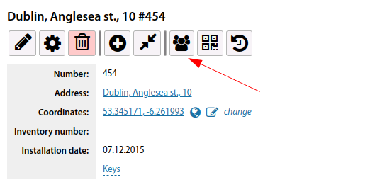
Communications installations card
Adding a new Communication node is done by clicking the "Add" button in this section.
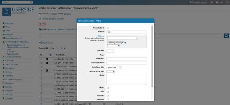
When adding a new Communication node, you must fill in the existing fields:
- Planned object (check the checkbox if it is a planned object)
- Number (specify node number)
- Address (Specify an existing address or leave an empty address for arbitrary location on the map)
- Entrance
- Floor
- Placement
- Inventory number
- Installation date
- Own icon on the map (if necessary, you can specify your own icon to be displayed)
- Owner of the object (if necessary, you can specify the owner of the object)
- Notes
- Marks (if necessary, you can set marks from the existing ones).
It is also possible to add communication nodes from the coverage map:
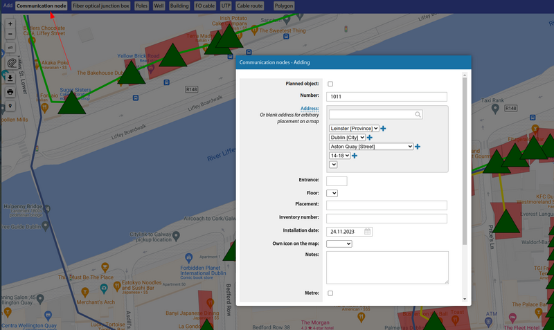
A communication node can be assigned to a specific building or can be arbitrarily placed on map. You can also specify node placement on multiple maps at the same time.
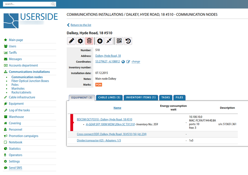
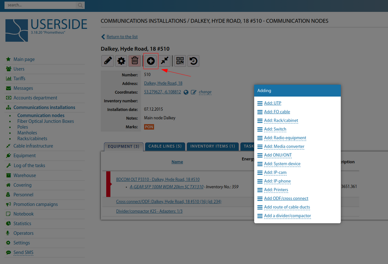
A communication node can have a variety of equipment and attach a variety of inventories directly, using the "Add" menu.
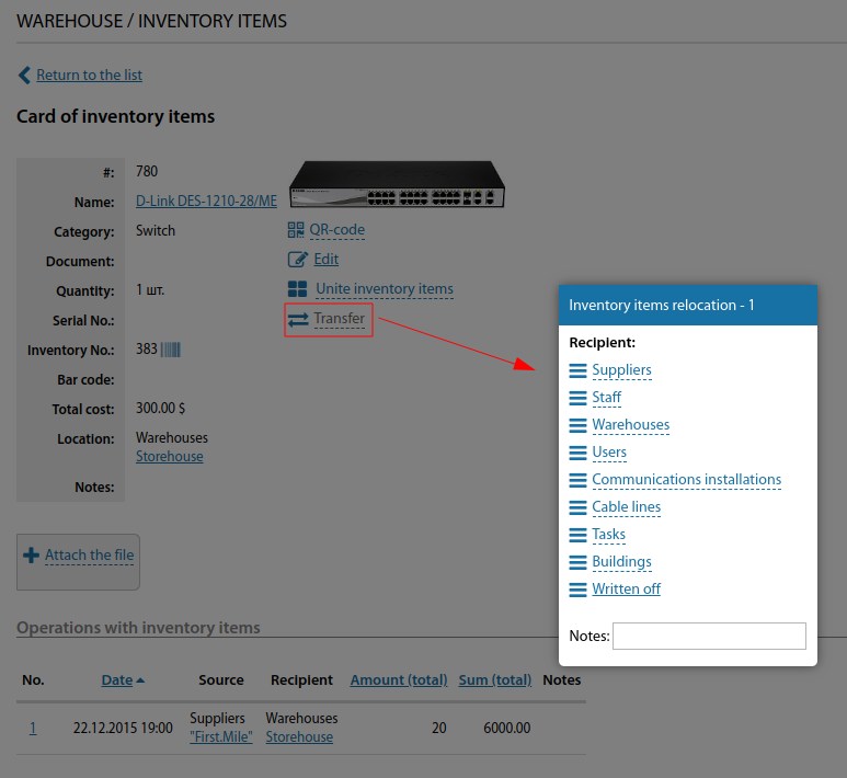
Or move it from the warehouse.
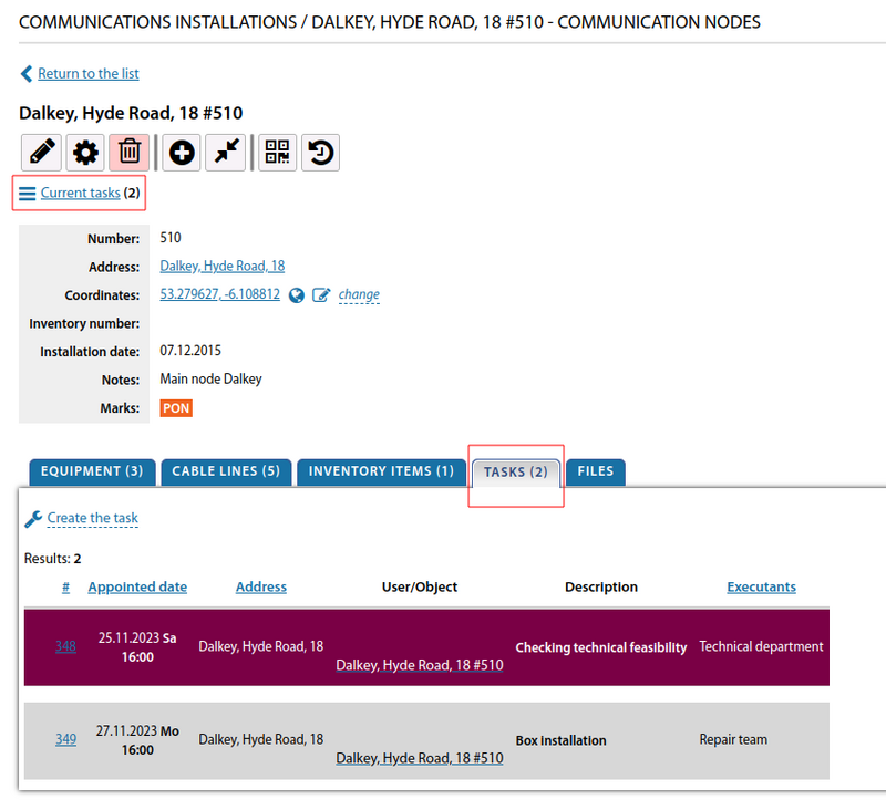
In the "Tasks" section, you can create new tasks and view existing tasks, for a given communication node.
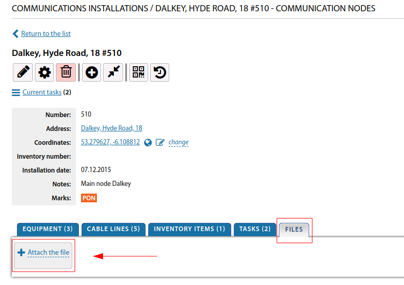
In the node card, it is possible to attach files with photos or other information.
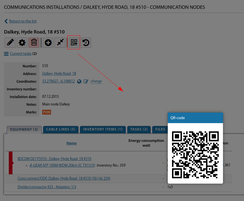
To generate a QR code, you can use the corresponding section. After its formation, it is possible to print the necessary QR codes and place them on the corresponding communication node. The engineer being at the object, using a device that can read QR codes (for example, a smartphone with the corresponding application) can quickly get access to the necessary node by the link.
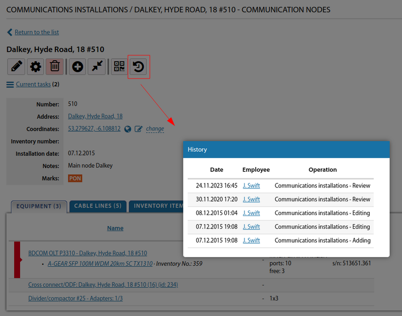
It is possible to view the transaction history of a given link node.
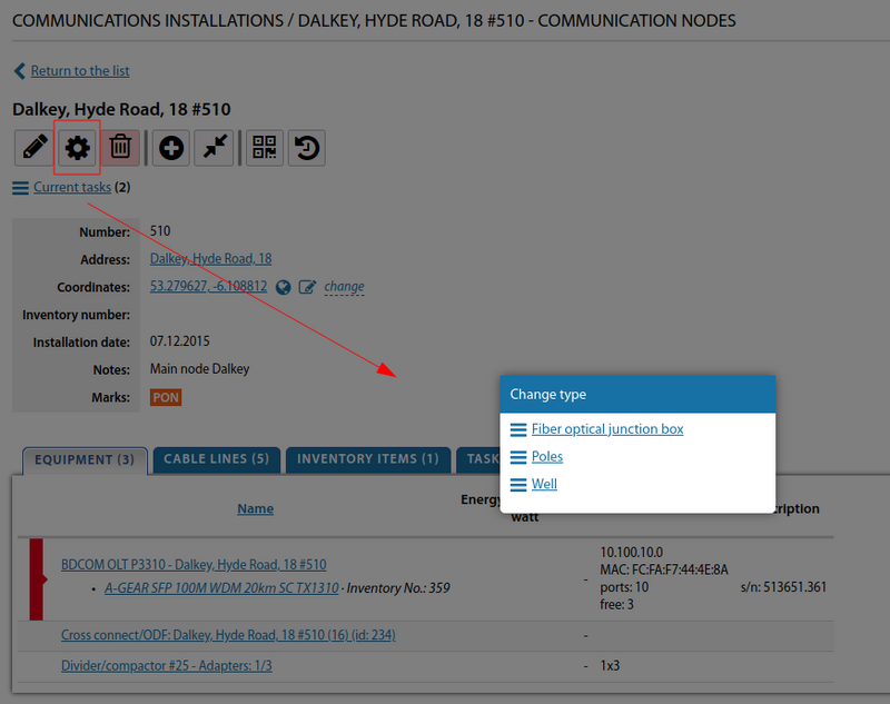
If necessary, you can change the type of Communications installations.
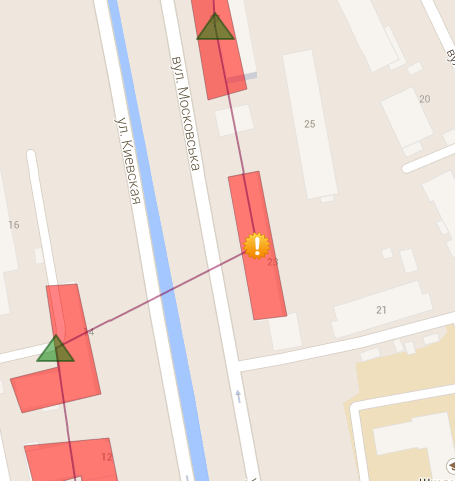
You can specify a specific mark icon for a communication node on the coverage map.
Starting from version 3.17, you can directly create a route of cable ducts from the card of a communication installation.
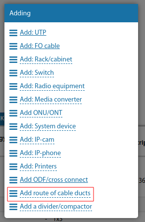
Starting from version 3.18:
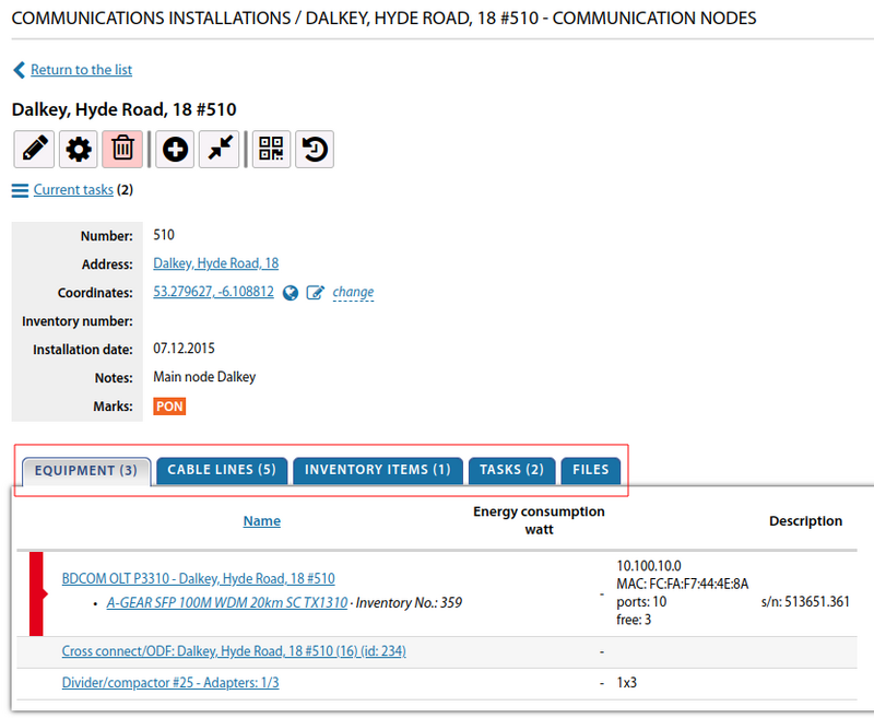
The map of a communication installation is divided into tabs, where objects from this communication installation (equipment, inventory, cable lines, etc.) are located..
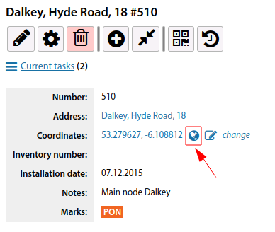
A link to view its coordinates on Google Maps has been added to the card of a communication installation
Starting from version 3.19:
For a communication facility, added the ability to build a list of customers dependent on this communication facility (on the equipment and cable lines on it)
