Adding buildings from the coverage map: различия между версиями
Нет описания правки |
|||
| Строка 1: | Строка 1: | ||
[[Adding_buildings_from_the_coverage_map|en]] | [[Добавление_зданий_с_карты_покрытия|ru]] | [[Adding_buildings_from_the_coverage_map|en]] | [[Добавление_зданий_с_карты_покрытия|ru]] | ||
'''Added in ERP "UserSide" 3.13''' | |||
''Covering - Coverage maps - Edit'' | |||
It is possible to add buildings and structures directly from the coverage map. | |||
To do this it is necessary to switch on the edit mode | |||
[[File:2024-04-22 17-43.png|thumb|800px|center]] | |||
Select which object we are adding (House), a marker will appear - move it to the location of the building and click on the map | |||
[[File:2024-04-22 17-45.png|thumb|800px|center]] | |||
The add new building dialogue box will appear. | |||
[[File:2024-04-22 17-48.png|thumb|800px|center]] | |||
[[File:2024-04-22 17-50.png|thumb|800px|center]] | |||
UserSide will use the marker coordinates to send a request to the ''(OpenStreetMap Nominatim)'' geo-service to get information about what the address of the building is according to these coordinates and will try to get in addition data about the boundaries of the polygon of this building. The polygon will be plotted on the map, and based on the text address data, the settlement of this building and the street from those already entered in UserSide will be found. | |||
Enter the necessary additional information and save. The building is added. | |||
[[File:2024-04-22 17-53.png|thumb|800px|center]] | |||
== Features == | |||
It should certainly be noted the following: | |||
1. Geo-services databases can be inaccurate and incomplete. The larger the settlement in which the building is added, the more likely it is that this address and the building polygon will be in the geo-services database. | |||
2. sometimes it happens that the text address is found by coordinates, but the polygon of the building contour is not found. | |||
[[File:2024-04-22 17-57.png|thumb|800px|center]] | |||
3. When the system receives a text address of a building, it tries to extract the name of the settlement, street name and house number from it. Based on this information, it tries to find such settlement and street in the settlements and streets ''([[Address system|address units]])'' already added in the database. If the settlement is found, but the street is not found - the required settlement will be selected, and the street name will be added to the house number. | |||
[[File:2024-04-22 17-58.png|thumb|800px|center]] | |||
4. When address information cannot be obtained by coordinates - the dialogue window of adding a new building will be with empty values. | |||
[[File:2024-04-22 17-59.png|thumb|800px|center]] | |||
See also: [[Coverage maps]] | |||
Текущая версия от 15:18, 22 апреля 2024
Added in ERP "UserSide" 3.13
Covering - Coverage maps - Edit
It is possible to add buildings and structures directly from the coverage map.
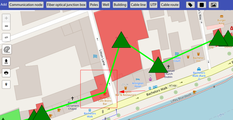
To do this it is necessary to switch on the edit mode
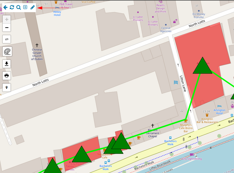
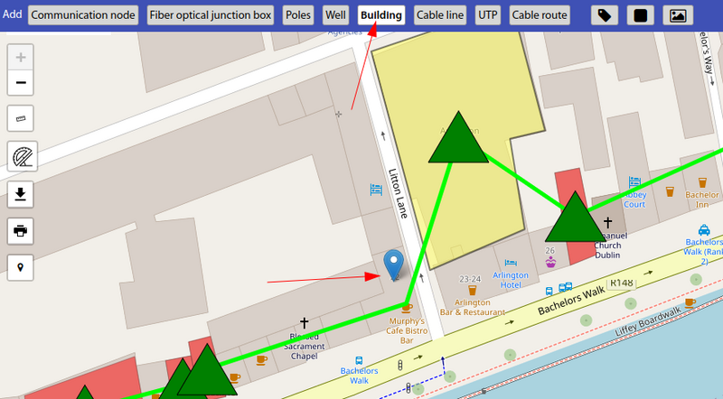
Select which object we are adding (House), a marker will appear - move it to the location of the building and click on the map
The add new building dialogue box will appear.
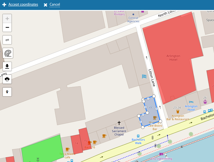
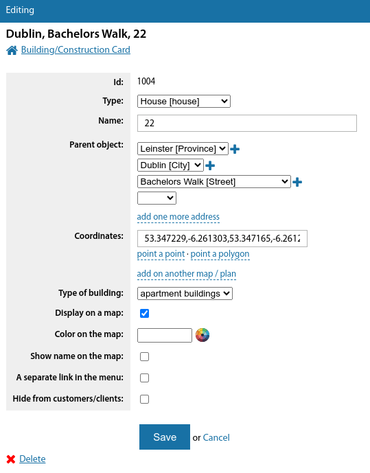
UserSide will use the marker coordinates to send a request to the (OpenStreetMap Nominatim) geo-service to get information about what the address of the building is according to these coordinates and will try to get in addition data about the boundaries of the polygon of this building. The polygon will be plotted on the map, and based on the text address data, the settlement of this building and the street from those already entered in UserSide will be found.
Enter the necessary additional information and save. The building is added.
Features
It should certainly be noted the following:
1. Geo-services databases can be inaccurate and incomplete. The larger the settlement in which the building is added, the more likely it is that this address and the building polygon will be in the geo-services database.
2. sometimes it happens that the text address is found by coordinates, but the polygon of the building contour is not found.
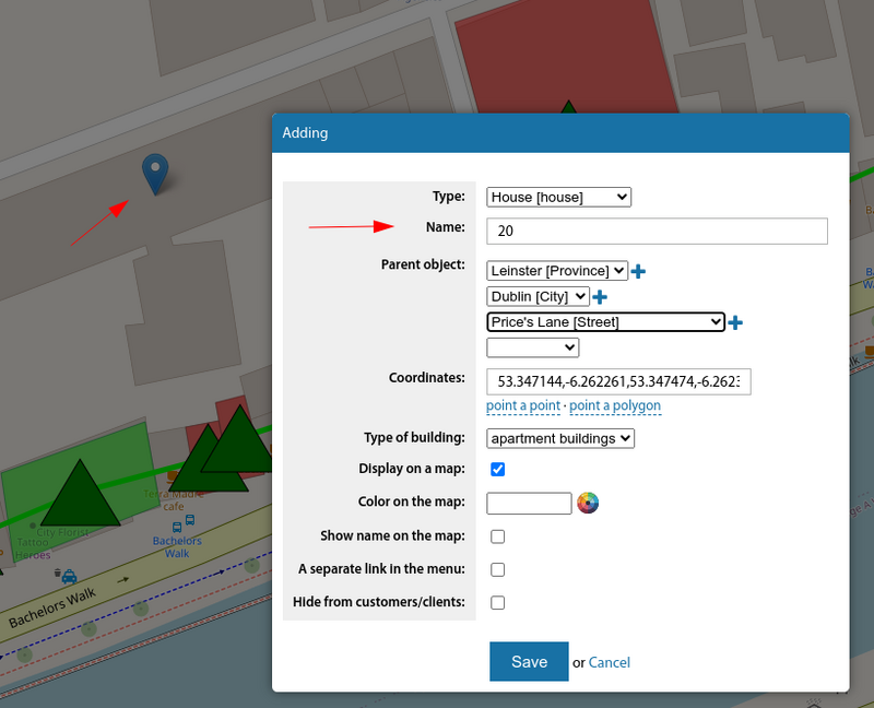
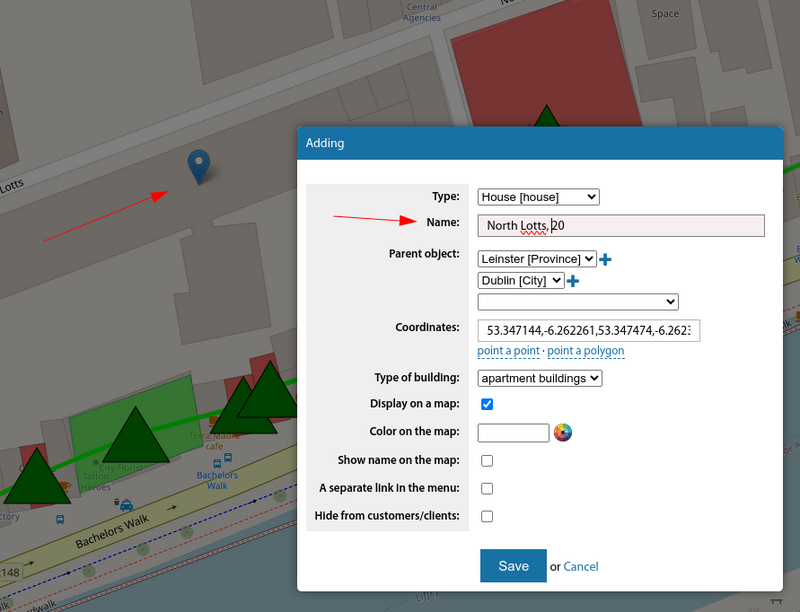
3. When the system receives a text address of a building, it tries to extract the name of the settlement, street name and house number from it. Based on this information, it tries to find such settlement and street in the settlements and streets (address units) already added in the database. If the settlement is found, but the street is not found - the required settlement will be selected, and the street name will be added to the house number.
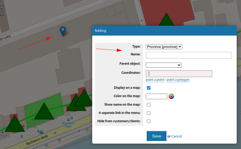
4. When address information cannot be obtained by coordinates - the dialogue window of adding a new building will be with empty values.
See also: Coverage maps